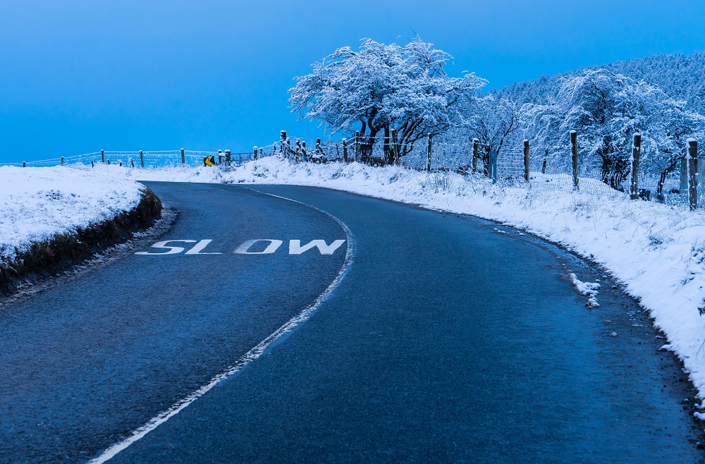
Dublin is currently not included in a Status Yellow snow and ice warning affecting 11 counties, as Met Éireann warns that parts of the country could face difficult travelling conditions and poor visibility.
The alert applies to Cork, Kerry, Limerick, Tipperary, Waterford, Donegal, Galway, Leitrim, Mayo, Sligo and Wicklow, and remains in place until 9am. However, Dublin has not been included in the warning, with the capital expected to avoid the worst of the wintry conditions for now.
A separate Status Yellow wind warning for Clare, Kerry and Galway expired earlier this morning at 6am, after blustery overnight conditions in parts of the west.
According to Met Éireann, showers may fall as sleet or snow in some areas through the morning, with some accumulations possible, particularly on higher ground in the affected counties. The forecaster also warned that surface water left behind by yesterday’s heavy rain could freeze, leading to icy stretches on untreated roads and footpaths.
Despite the warnings across much of the country, Dublin remains outside the alert area, meaning commuters in the capital are less likely to face the same wintry hazards seen elsewhere this morning.
Met Éireann forecaster Siobhán Ryan said a change in air mass is already underway as “the winds have veered westerly in direction.”
“When they begin to veer westerly, we know that that change in air mass has already occurred, so the temperatures … are falling back quite markedly in across the north and west,” she said, adding that temperatures are also expected to drop “quite dramatically” in the coming hours across the south and east.
Ms Ryan said “the temperatures might come in around 0°C to 3°C overnight, but it's going to feel colder, because obviously there's going to be a wind-chill factor … so that's going to steer down some sleet and snow showers.”
Ms Ryan described the weather as “routine March weather,” noting that temperatures should rise slightly over the weekend, although “there's still going to be a little edge on it.”
Looking ahead, she said Saturday is likely to be the better day, with “long dry spells”, while Sunday will see the return of the wind-chill factor.
Conditions are expected to remain changeable into next week, and for St Patrick’s Day there may be “a bit cloudy, not so cold, but probably a spell of rain at some stage.”
Beyond that, Ms Ryan said there are tentative signs of high pressure building.
She added that “anything goes” when it comes to St Patrick’s Day weather, explaining that “it can be dry and sunny, the most you can hope for is temperatures in the high teens at the very, very best.”
“But you can also experience temperatures in the low single figures … and I think for this St Patrick's Day it's going to be somewhere in between those.”